
TL;DR

Get everyday essentials delivered free with Prime
- Fast, free delivery on millions of items
- Prime Video, Amazon Music and more included
- Member-only deals all year
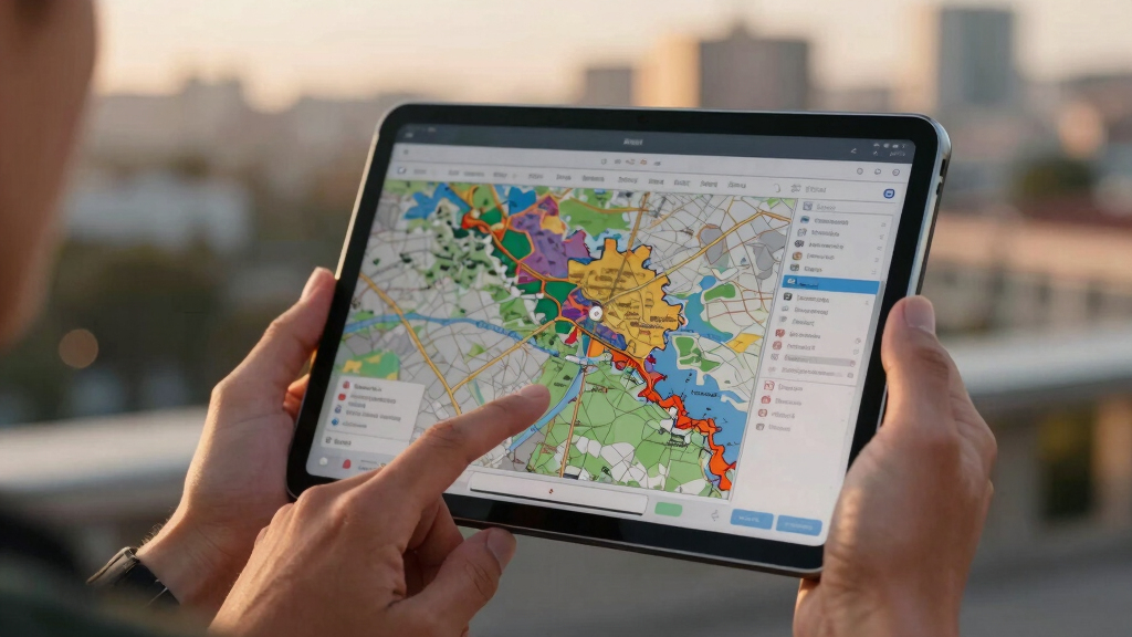
War Atlas, an interactive digital map, has been launched to document every named war in human history. This tool aims to serve researchers, educators, and the public by offering a comprehensive visual record. The project is ongoing, with further updates expected.
War Atlas, a digital platform presenting an interactive map of every named war in human history, has been officially launched. The project aims to serve researchers, educators, and the public by providing a detailed visual record of conflicts across time and geography. This development marks a significant step toward consolidating historical conflict data into an accessible, global format.
The platform, developed by a team of historians and data scientists, consolidates over 10,000 conflicts, from ancient battles to modern wars, into a single interactive map. Users can explore wars by time period, region, or conflict type, with detailed information available for each event, including dates, belligerents, and outcomes. The project is hosted online and is freely accessible, with plans for continuous updates as new conflicts are documented and historical data refined. According to the War Atlas team, the platform aims to facilitate research, education, and public understanding of the human cost of conflict across centuries.Development of the platform involved extensive collaboration with historians, archivists, and geospatial analysts, integrating data from multiple sources including academic databases, historical archives, and open-source datasets. The platform features a user-friendly interface designed to accommodate both casual users and specialists. The team emphasizes that the database is still expanding, and some conflicts, especially lesser-known or disputed ones, may have incomplete information or be subject to future revisions.
Potential Impact on Historical and Educational Research
The War Atlas project offers a comprehensive, visual tool that could revolutionize how conflicts are studied and understood. By providing a global, interactive record, it allows users to identify patterns, understand regional conflict histories, and analyze the frequency and duration of wars across different eras. Educators can utilize this resource for teaching history in a more engaging way, while researchers may find new insights through spatial and temporal analysis. The platform’s accessibility could also increase public awareness of the historical human toll of wars, fostering a more informed understanding of current conflicts.
As an affiliate, we earn on qualifying purchases.
Historical Efforts to Document Conflicts and Digital Innovation
Historically, conflict data has been scattered across archives, books, and academic papers, making comprehensive analysis difficult. Previous digital efforts have focused on specific conflicts or regions, but few have attempted a global, inclusive database. The launch of War Atlas represents a significant advancement in digital history, leveraging geospatial technology to visualize conflicts across all periods. Similar projects have existed in limited scopes, but this platform aims to be the most comprehensive, covering conflicts from ancient Mesopotamian battles to contemporary wars.
The project builds on the increasing trend of using GIS (Geographic Information Systems) and digital mapping in historical research, integrating multiple sources to create a unified, interactive experience. It also responds to a growing demand for accessible, digital tools that make complex historical data more understandable and engaging for broad audiences.
“War Atlas aims to be the definitive visual record of human conflict, making history accessible and engaging for everyone.”
— Dr. Emily Carter, project lead
As an affiliate, we earn on qualifying purchases.
Extent of Data Completeness and Future Updates
While the platform includes over 10,000 conflicts, it is still expanding, and some data—particularly for ancient or less-documented wars—may be incomplete or disputed. The team acknowledges ongoing challenges in verifying sources and integrating new conflicts as historical research progresses. It remains to be seen how frequently updates will occur and how the platform will handle conflicting historical accounts.
As an affiliate, we earn on qualifying purchases.
Planned Features and Ongoing Data Integration
The War Atlas team plans to expand the database further, integrating more conflicts, refining existing data, and adding features such as detailed conflict timelines, casualty estimates, and user-contributed data. Future updates may include enhanced visualization tools and educational modules. The platform is expected to evolve as new historical research emerges and user feedback is incorporated.
As an affiliate, we earn on qualifying purchases.
Key Questions
How comprehensive is the current War Atlas database?
The platform currently includes over 10,000 conflicts, spanning from ancient to modern times, but some conflicts—especially lesser-known or disputed ones—may have incomplete data.
Can I contribute to the War Atlas?
At this stage, the platform primarily relies on curated data from academic and historical sources. Future versions may include user contributions, but this has not been confirmed.
Is the War Atlas accessible to the public for free?
Yes, the platform is freely accessible online, aimed at researchers, educators, and the general public.
What are the plans for future updates?
The team plans to expand the database, add more detailed features, and improve visualization tools based on ongoing research and user feedback.
Source: hn
Fall Picks
fall essentials
As an affiliate, we earn on qualifying purchases.